


VTD-precinct 5, Spink County, South Dakota
About
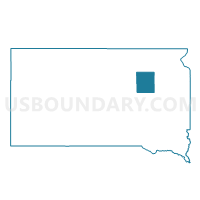
Outline

Summary
| Unique Area Identifier | 667780 |
| Name | VTD-precinct 5 |
| County | Spink County |
| State | South Dakota |
| Area (square miles) | 163.71 |
| Land Area (square miles) | 162.90 |
| Water Area (square miles) | 0.81 |
| % of Land Area | 99.51 |
| % of Water Area | 0.49 |
| Latitude of the Internal Point | 44.83176670 |
| Longtitude of the Internal Point | -98.28434990 |
Maps


Graphs
Select a template below for downloading or customizing gragh for VTD-precinct 5, Spink County, South Dakota


Neighbors
Neighoring Voting District (by Name) Neighboring Voting District on the Map
- VTD-precinct 1, Spink County, SD
- VTD-precinct 12, Beadle County, SD
- VTD-precinct 15, Beadle County, SD
- VTD-precinct 3, Spink County, SD
- VTD-precinct 4, Spink County, SD
- VTD-precinct 6, Spink County, SD
- VTD-precinct 7, Spink County, SD
Top 10 Neighboring County Subdivision (by Population) Neighboring County Subdivision on the Map
- Lincoln township, Spink County, SD (241)
- Lake Byron township, Beadle County, SD (182)
- Frankfort city, Spink County, SD (149)
- Altoona township, Beadle County, SD (82)
- Prairie Center township, Spink County, SD (81)
- Lodi township, Spink County, SD (80)
- Belle Plaine township, Spink County, SD (79)
- Crandon township, Spink County, SD (73)
- Belmont township, Spink County, SD (65)
- Harmony township, Spink County, SD (63)
Top 10 Neighboring Place (by Population) Neighboring Place on the Map
Top 10 Neighboring Unified School District (by Population) Neighboring Unified School District on the Map
- Redfield School District 56-4, SD (3,549)
- Northwestern Area School District 56-7, SD (1,800)
- Hitchcock-Tulare School District 56-6, SD (1,335)
- Doland School District 56-2, SD (849)
Top 10 Neighboring State Legislative District Lower Chamber (by Population) Neighboring State Legislative District Lower Chamber on the Map
- State House District 2, SD (21,657)
- State House District 22, SD (21,252)
- State House District 6, SD (19,896)
Top 10 Neighboring State Legislative District Upper Chamber (by Population) Neighboring State Legislative District Upper Chamber on the Map
- State Senate District 2, SD (21,657)
- State Senate District 22, SD (21,252)
- State Senate District 6, SD (19,896)
Top 10 Neighboring 111th Congressional District (by Population) Neighboring 111th Congressional District on the Map
Top 10 Neighboring Census Tract (by Population) Neighboring Census Tract on the Map
- Census Tract 9566, Beadle County, SD (1,999)
- Census Tract 9567, Beadle County, SD (1,922)
- Census Tract 1, Spink County, SD (1,910)
- Census Tract 3, Spink County, SD (1,786)